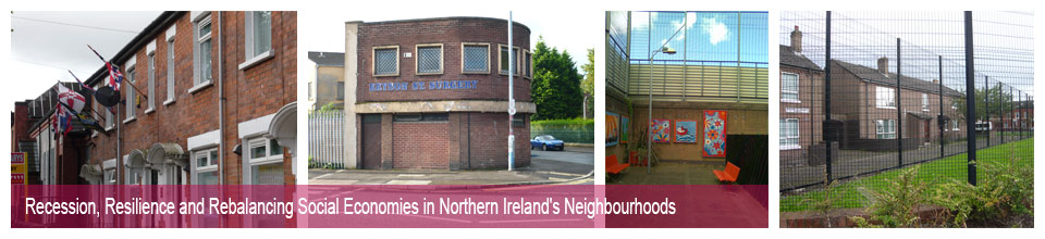
Inner East Belfast
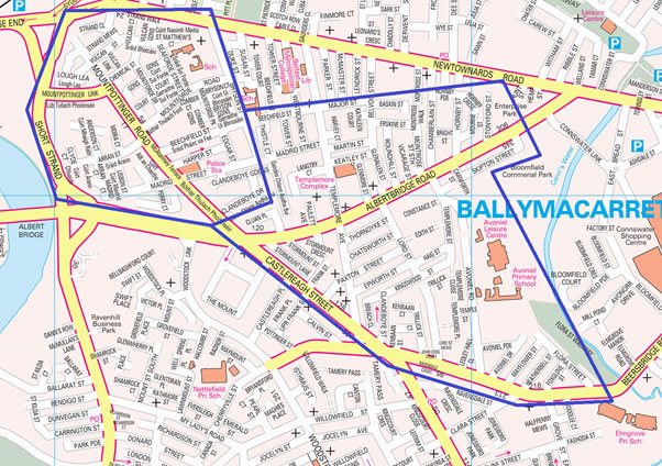
This divided and disadvantaged inner urban area in the city of Belfast, has been the site of considerable sectarian conflict over the years. As highlighted in the map below, it is located in the Inner East Belfast area of the city, including Lower Castlereagh and Short Strand within the Ballymacarrett and The Mount electoral wards. Interfaces at Bryson Street/Newtownards Road and Mountpottinger Road/Albertbridge Road have been the site of conflict over the years. The recent protests over a reduction of the flying of the union flag at Belfast City Hall have seen extensive rioting in the area from December 2012-March 2013.
The Lower Castlereagh area has a population of 3891 in 1897 households. Although considered to be predominantly of Protestant community background, it actually contains 66 per cent Protestant and 20 per cent Catholic residents, along with the highest proportion in the case study areas claiming to be brought up in no religion (13 per cent)1. 27 per cent of households contain dependent children. The area includes part of the Mount electoral ward, which recorded the fourth biggest decrease in the recorded Protestant population between 2001 and 2011.2
Housing tenure is 24 per cent owner occupation, 44 per cent social housing and 26 per cent private rented. The built form is low rise and predominantly terraced (whatever the age of the houses), with some semi-detached housing and small apartment blocks. Castlereagh Street, the Albertbridge Road and the Newtownards Road provide local shops and other facilities, and the nearby Connswater Shopping Centre includes many larger shops including supermarkets and other chain stores selling a wide range of goods. Public transport links to the nearby city centre are also good. The local Avoniel Leisure Centre is currently being refurbished. Unemployment is seven per cent and economic inactivity due to long-term sickness or disability is ten per cent; 39 per cent of residents have some kind of long term health condition.
The area includes a number of community groups and initiatives, many church-based, such as the new Skainos Centre on the Newtownards Road. The East Belfast Community Development Agency (EBCDA) is about to move into new premises on Templemore Avenue, that will include space for new social economy businesses and the historic Templemore Baths which has now re-opened as the Templemore Swim and Fitness Centre. However, the area remains blighted by sectarian territorial markings such as murals and flags, to a much greater extent than the other case studies and more so in Lower Castlereagh than in the Short Strand. Community activity in Lower Castlereagh appears fragmented.
The Short Strand area has a population of 2,366 in 1041 households, and is predominantly of Roman Catholic community background (81 per cent). 36 per cent of households contain dependent children. Housing tenure is 36 per cent owner occupation, 48 per cent social housing, and 11 per cent private rented. The area contains high density housing, mainly from the 1980s on the city side of Mountpottinger Road and a mix of older and more recent housing on the other side extending to the Bryson Street ‘peace wall’. There are a few shops on Mountpottinger Road and a doctors’ surgery at the end of Bryson Street; some might shop in the Castlereagh Road or at Connswater Shopping Centre, but given recent tensions this is less likely and the Avoniel Leisure Centre is definitely not regarded as safe - residents use Leisure Centres in the Lower Ormeau or the Falls. City centre shopping amenities are close by. Unemployment is eight per cent and economic inactivity due to due to long-term sickness or disability is six per cent; 37 per cent of residents have some kind of long term health condition. The Short Strand Community Centre and Community Forum provide a focus for community activity in the area, as does the Doyle Youth Club. Residents also participate in the East Belfast Partnership and the EBCDA.
Research activities in the Inner East Belfast case study are being coordinated by Dr Jenny Muir (j.muir@qub.ac.uk / 028 9097 4835) from Queens University Belfast, please do not hesitate to contact her if you have any queries about our work in the area.
Footnotes